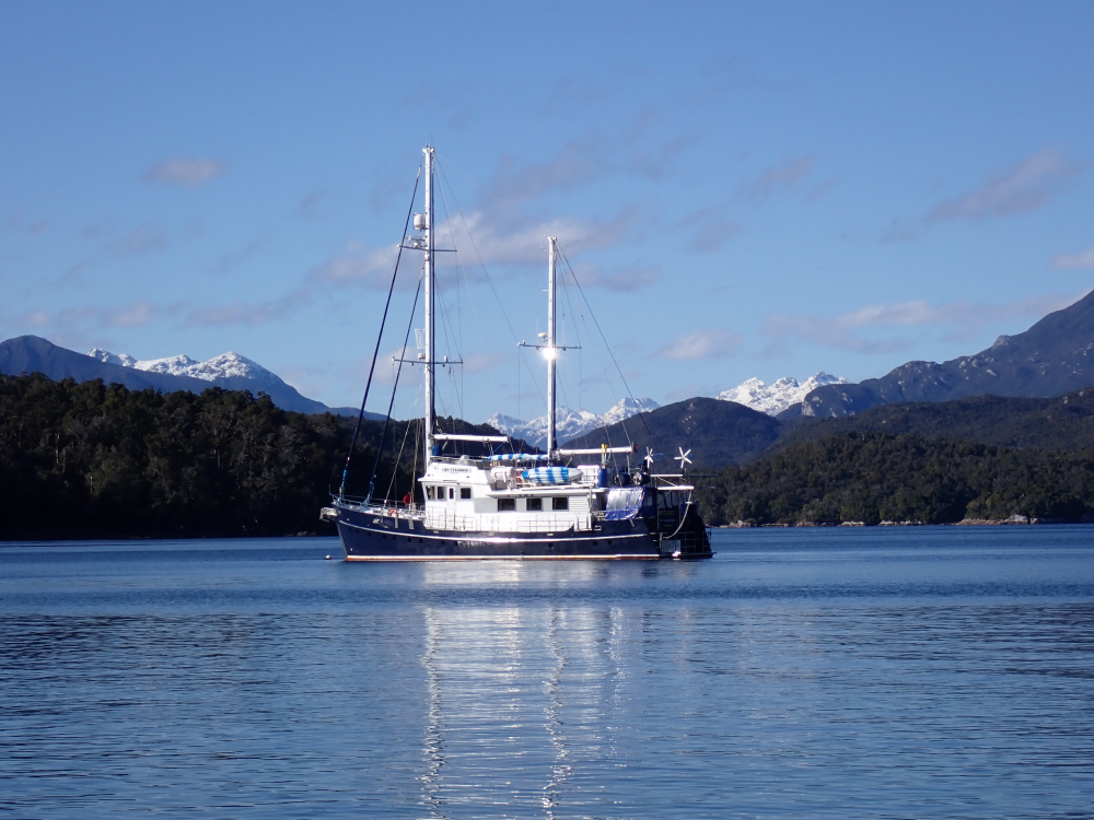
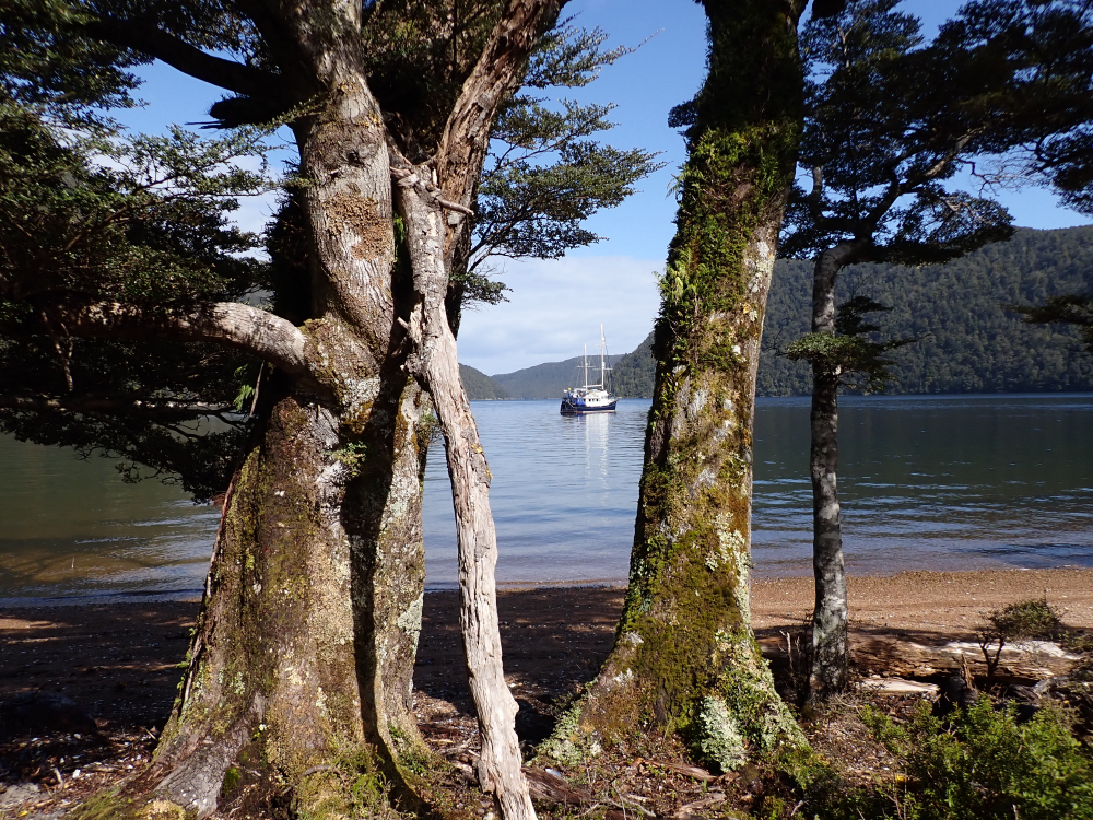
Strannik anchored up peacefully in Cuttle Cove.
ONE OF THE WORLD’S GREATEST & REMOTEST CRUISING GROUNDS
Part seven on the journey of the MV Strannik, Rodney Russ continues his voyage into Fordland in the final of a two part series on this magnificent boating playground.
In Māori legend, the fiords in Fiordland were formed by a God named Tu-te-Rakwhanoa. Chanting a powerful Karakia, or prayer, he hacked at the towering rock walls with his adze, carving them from the earth. Reputedly he started at the south, working his way north to Milford Sound. At the start he was inexperienced and had to chop repeatedly, leaving many islands and inlets. His inexperience created what is arguably one of the world’s finest and remotest cruising grounds.

In this the second article on Fiordland we look at the cruising opportunities in Breaksea Sound, Dusky Sound, Chalky Inlet and Preservation Inlet. All these are technically fiords and are often collectively referred to as the Southern Fiords. Their topography differs from the Northern Fiords (see previous article) in that they are much more expansive, and the surrounding land is not nearly as mountainous or precipitous, in fact Preservation Inlet in the south feels and looks more like a sound than a fiord.
The Southern Fiords can be approached from the east departing from either the Port of Bluff or Stewart Island, via Foveaux Strait. This strait has a fearsome reputation, being shallow and lying wide open to the prevailing westerly winds and seas. Many a yachtsman has sat for days, if not weeks, waiting for a suitable weather window. Alternatively, they can be approached from the North by cruising down the west coast of the South Island and through the Northern Fiords (see previous article). We will continue with the Northern approach in this article.
DOUBTFUL SOUND
Deep Cove at the head of Doubtful Sound is a good place to replenish water, fuel (both diesel and petrol) and to arrange for fresh supplies brought in from Te Anau. There are a couple anchorages near the entrance to Doubtful Sound that provide ideal jumping off points, places to sit and wait for the best weather and sea conditions to run south. These include Snug Cove at the head of First Arm, or Blanket Bay, in the shelter of Secretary Island. As you depart Doubtful Sound you will (if you are observant) note a little cluster of Spanish place names on the chart. These were bestowed by a Spanish expedition of 1793 under the command of Captain Alessandro Malaspina.
He only visited for one day and instead of bringing their vessels the Descubierta and Atrevida into the fiord, he sent a long boat in because, like Cook, who named the fiord in 1770, he was doubtful if they could safely sail in and out.
Eight miles south of Doubtful Sound is a little known, seldom visited and underappreciated fiord called Dagg Sound; if you have the time there is the most picturesque and secure anchorage at its head. From this anchorage there is an easy one hour walk (each way) to the head of Crooked Arm in Doubtful Sound.
The Dusky Sound complex includes Breaksea Sound, the Acheron Passage, Wet Jacket Arm and Dusky Sound proper and includes a labyrinth of waterways and an estimated 700 plus islands. The take-home message is simple, allow plenty of time. The upper Breaksea Sound divides into two arms, Vancouver and Broughton, immortalising the captains from a 1795 expedition to Dusky Sound. Vancouver had been a young midshipman with Cook in 1773 when Cook had named this area on his chart as “Nobody knows what”, when he returned as Commander of his own expedition he was determined to fill in the gaps. Their two ships the Discovery and the Chatham have also been commemorated in two prominent headlands near where these arms divide. It is worth sailing to the head of at least one of these arms to really sense the remoteness, grandeur and beauty of the area. Both have reasonable anchorages, with Vancouver Arm having a substantial mooring buoy.
ACHERON PASSAGE
The Acheron Passage is an eight-mile-long inland waterway connecting Breaksea Sound and Dusky Sound. Cook named it the New Passage, however the name was changed in 1851 to Acheron to commemorate the survey vessel Acheron which completed the first official charts of Dusky Sound. Midway through the passage is Wet Jacket Arm, named by Cook after Lieutenant Pickersgill got caught out in a storm and had to spend a wet night huddled under his boat. In 1910 moose were liberated in the nearby Seaforth River; just one of eleven species of deer to be liberated in New Zealand to satisfy the hunting urges of the early settlers. The habitat was marginal and the moose never established, and the eight animals that were shot were shot in Herrick Creek near the head of Wet Jacket Arm. Red deer were also liberated in large numbers (some 230 liberations) and are now well established in Fiordland and can often be seen on the beaches, or spooked during bush walks.
At the very head of Dusky Sound is Supper Cove (Cook had supper here), this is the terminus of a demanding four or five-day tramp from Lake Manapouri. The Supper Cove hut is on the North Bank of the Seaforth River which flows into the Fiord. Supper Cove was also the site of an ambitious, but doomed to fail, attempt at building a road through Fiordland. During the depression of 1903, 50 unemployed miners from the west coast of the South Island were shipped here and started construction, only 9.5 kms of road were built before the project was abandoned. There is a good mooring in nearby Shark Cove, a much more sheltered anchorage than Supper Cove which can experience severe weather conditions at times.

It is approx. 16 nm from Supper Cove to the outer Dusky Sound area where there is a lot to see and do; you have the choice of travelling via the Bowen Passage or the Cook Channel. If you take the latter take care around 9 fathom passage. Whichever way you go make sure you visit Sportsman Cove on the western end of Cooper Island, named by Cook after a successful morning’s hunting, it is an idyllic anchorage (there is a mooring) but is subject to hard to predict local weather phenomena.
Duck Cove on Resolution Island is readily accessible from the Bowen Channel; there is a water pipe from a creek halfway along the western shoreline from which you can top up you water tanks.
Cascade Cove makes a great base from which to explore the outer Dusky Sound area. There are a number of moorings in the head of Cove. If you prefer to anchor the holding is good.
On the must do/see and experience list in this part of Dusky Sound are: –
a) Pickersgill Harbour and a walk to Lake Forster.
Cook moored his ship the Resolution here for 33 days in 1773 after his journey across the Southern Ocean and across the Antarctic Circle (the first vessel to do so) from Cape Town. There is a boardwalk around the small knoll and a photometric plaque with some information to help with your visit. There is a marked but muddy track to Lake Forster named after the father and son naturalists who accompanied Cook on this expedition.
b) Luncheon Cove on Anchor Island and walk to Anchor Island lake and beyond.
Anchor Island was named by Cook because he anchored nearby on his first night in Dusky Bay and Luncheon Cove because he enjoyed lunch here during his exploration of Dusky Sound.
The island is now synonymous with the Kākāpo because it is on this island that Department of Conservation are concentrating their efforts to save this rare (less than 300 individuals remain) flightless and nocturnal parrot. The chances of seeing one of these is virtually nil but make an effort to enjoy a walk to the lake. The Island is predator free and some of NZ’s rarest birds like the Yellow Head and Saddleback have been liberated here. The bird song is special, perhaps somewhat reminiscent of what NZ forests were like before the arrival of people.
c) Pigeon Island.
This was home for Richard Henry, caretaker of nearby Resolution Island, New Zealand’s first Nature Reserve gazetted in 1891. He was appointed in 1894 as there were concerns about the impact of introduced rats and stoats on the native avifauna, many of which were either flightless or very poor fliers. Henry caught and liberated over 700 kiwi and Kākāpo on to Resolution Island. In 1900 he saw a stoat on the island, he never transferred another bird after that. Remnants of his house and boatsheds can be seen on Pigeon Island.
d) Facile Harbour.
Historically a very significant New Zealand site, arguably the cradle of the country’s European settlement and a site of many New Zealand firsts. The ship Endeavour was wrecked here in 1795 the first European shipwreck; the survivors included European women, the country’s first. It is unsubstantiated, but highly likely, that a child, or children, were conceived and born here during their enforced stay (the last of the survivors weren’t rescued until 1797), these would be the first European children born in the country. Some of the survivors completed the construction of a vessel that had been begun two years earlier by a sealing gang, they named it Providence and sailed to Norfolk Island.
This was the first European vessel built from native timber, possibly the first built from local timber in Australasia.
At low tide on a calm day it is still possible to see the ballast stones of the Endeavour.
CHALKY INLET
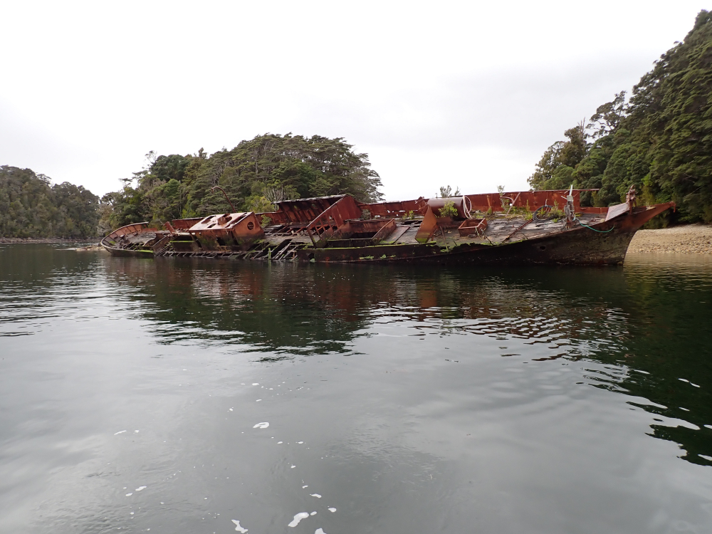
The penultimate Fiord on your journey south is Chalky Inlet, the name first appearing on Jules de Blosseville’s 1823 chart, named after the very obvious chalky (limestone) cliffs of Chalky Island, which you will see as you sail in. There are two anchorages known locally as South Port, or Lee Bay, and North Port. South Port is a good anchorage if the weather is from the South-Southwest, and North Port is good if weather is from Northerly quarter. In North Port make the effort to visit the hulk of the SS Stella, it was scuttled here in the 1940’s as a platform for a fish processing plant. Unfortunately, it rolled to starboard as it settled rendering it more or less unusable. SS Stella was a government vessel used to service the lighthouses and transport expeditions to remote places like Fiordland and is a piece of New Zealand’s maritime history.
PRESERVATION INLET
The voyage from Chalky Inlet into Preservation Inlet around Gulches Head is only a short distance, but it is potentially one of the roughest, so be prepared, it can be like being in a washing machine, but once inside Preservation Inlet there is a selection of first-class anchorages. Cuttle Cove is an historic anchorage and the site of the first land based whaling station, employing over 80 men at its peak in the late 1820’s. There is no physical evidence remaining, just a small plague on a rock. Two potential fishing villages, Dingwall and Cromarty were surveyed in 1869 in Preservation Inlet, but nothing came of either of until gold was discovered in the late 1880s.
Call them on channel 10 to make arrangements.
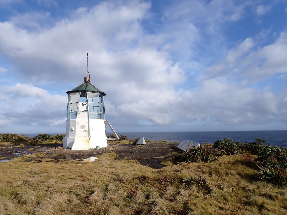
A lighthouse at Puysegur Point has marked the southern entrance to Preservation Inlet since 1879, the lighthouse there today is not the original lighthouse, that having been burnt down by an arsonist (a disgruntled goldminer) tired of the light flashing in his hut window on nearby Coal Island. The present light is fully automated, the last of the lighthouse keepers leaving in the early 1980s. It is well worth a visit. Follow the old roadway/track from the Oil Store at the southern end of Otago’s Retreat; it takes one hour each way.
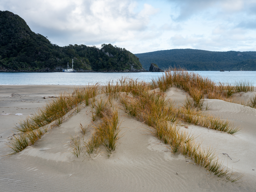
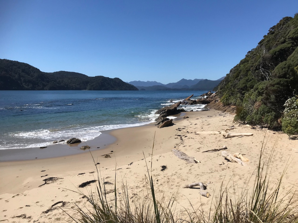
The golden sand beaches of Spit Beach are a great place on which to finish a visit to Preservation Inlet and Fiordland. If it is too rough to anchor off the beach, there is a track from a small unnamed gravel beach at 46˚ 04 651 S 166˚38 912 E. The small island, marked on the charts as Spit Island, or Matauira, was the last stronghold of a Māori people known as the Kāti Māmoe, who had inhabited the South Island until they were challenged by a North Island tribe known as the Kāi Tahu. The battles were many, both fierce and bloody. A truce was evidently made between the two tribes but some of the Kāti Māmoe who refused to accept the truce retreated to this small island pursued by the Kāi Tahu. Both tribes sustained significant losses in the final battle, the outcome of which has been and will continue to be debated by historians
I believe that one thing that isn’t debateable is that these fiords are amongst the world’s greatest cruising grounds. I encourage you to explore them yourselves and then make your own opinion.