C-MAP has launched a re-designed, simplified charting portfolio for Lowrance, Simrad, and B&G chartplotter with C-MAP Discover & Reveal’s introduction.
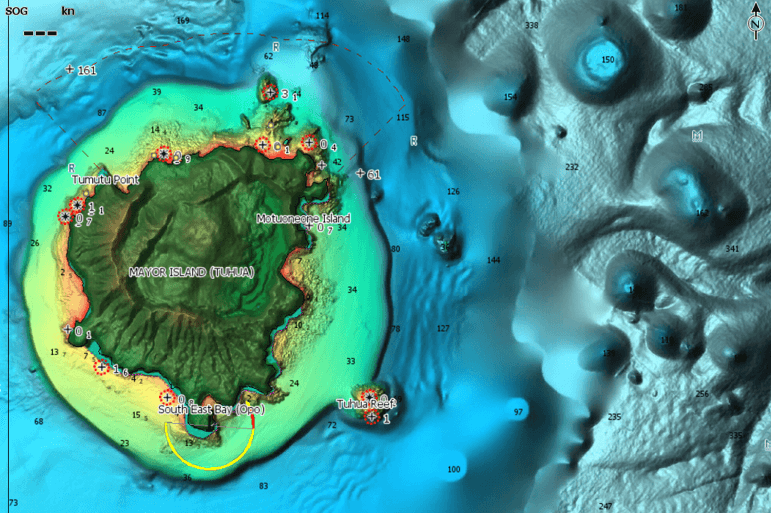
Replacing the MAX-N+ range, C-MAP REVEAL charts display the very best of C-MAP. It boasts stunning seafloor and inland Shaded Relief and all the core features of C-MAP DISCOVER, including full-featured Vector Charts.

“This is a significant evolution for C-MAP,” explains Max Cecchini, EVP C-MAP. “We have heard our customers telling us that C-MAP’s range was too complicated, and we’ve adapted – with a simple, two-tier product range which brings the strongest data to all products, including the ‘Entry Level+’ DISCOVER.”
With 3D-rendered land and underwater elevation including areas of Ultra-High-Res Bathymetric imagery, previously only available in MAX-N+ Reveal, this is a game-changer for anglers and divers.
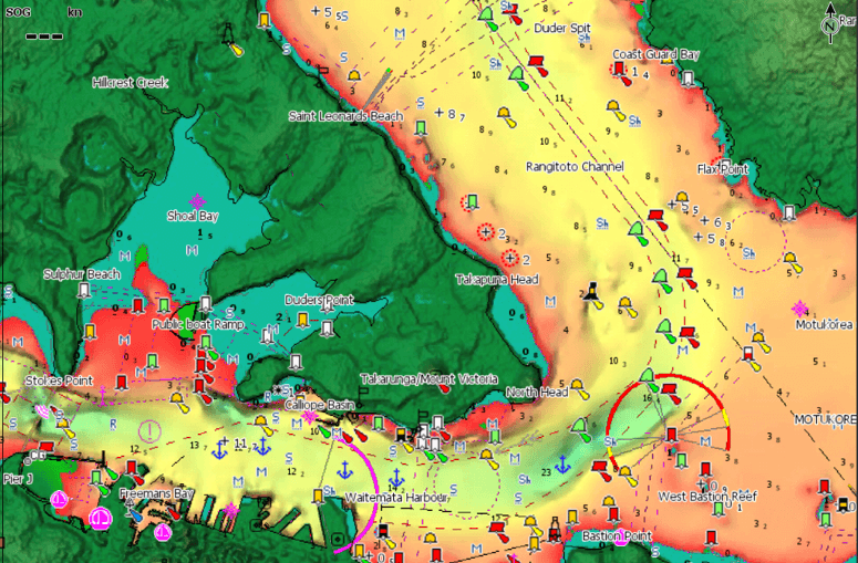
C-MAP Reveal also offers Dynamic Raster Charts, bringing a traditional paper chart look and feel, easy access to all objects on the chart, and aerial photography providing an additional level of details with thousands of photos of marinas, harbours, inlets and other notable navigational features.
REVEAL’s Satellite Overlay delivers real-world reference and enhances situational awareness for coastal navigation should you find yourself in unfamiliar surroundings.
Whether cruising, fishing or sailing, C-MAP DISCOVER offers a choice of coverages and includes all the core features needed to make the most of your time on the water. DISCOVER has full-featured Vector Charts and the best of C-MAP High-Res Bathymetry, including integrated Genesis® social maps data.
DISCOVER charts include Custom Depth Shading. Shade contours display the highest level of information about underwater pinnacles, ledges and canyons. You can set a clear safety depth or create your own custom shading – an evergreen popular feature for fishing.